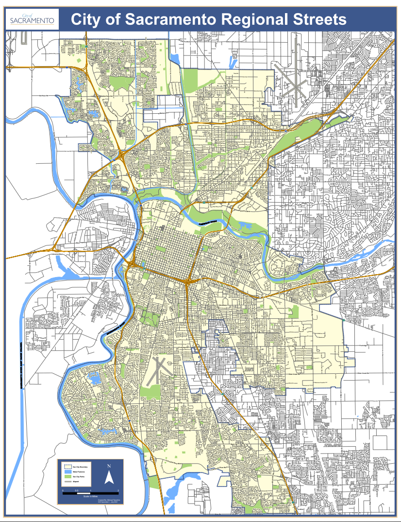
Map Gallery
The City Map Gallery is a collection of ready-to-print maps as well as links to various City departments' maps. There are many maps available such as council district, historic districts, parks, and land-use maps.
For the most up-to-date council district maps please visit the Council District Print application where you can print your own maps.
To see other City of Sacramento interactive maps visit our Interactive Maps and Tools page.
All maps below are available in Adobe PDF format.
Disclaimer: All maps & data provided are subject to Terms of Use identified in the City of Sacramento Open Data policy.
Citywide Council District maps
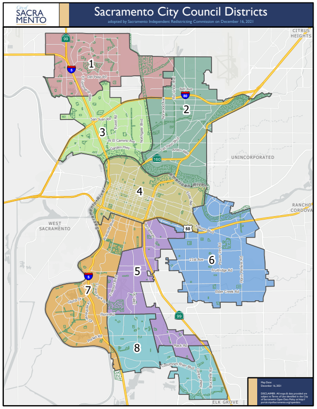
Updated 12/16/2021
Updated 12/16/2021
Council District 1 maps
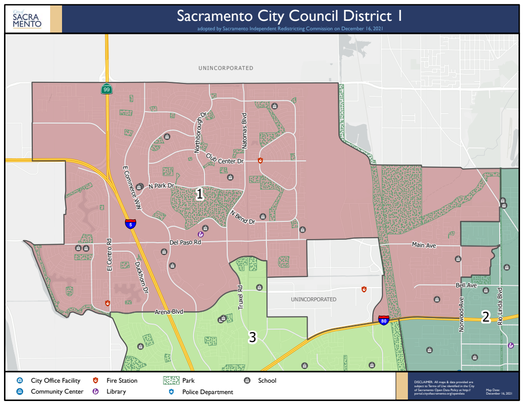
Updated 12/16/2021
Updated 12/16/2021
Council District 2 maps
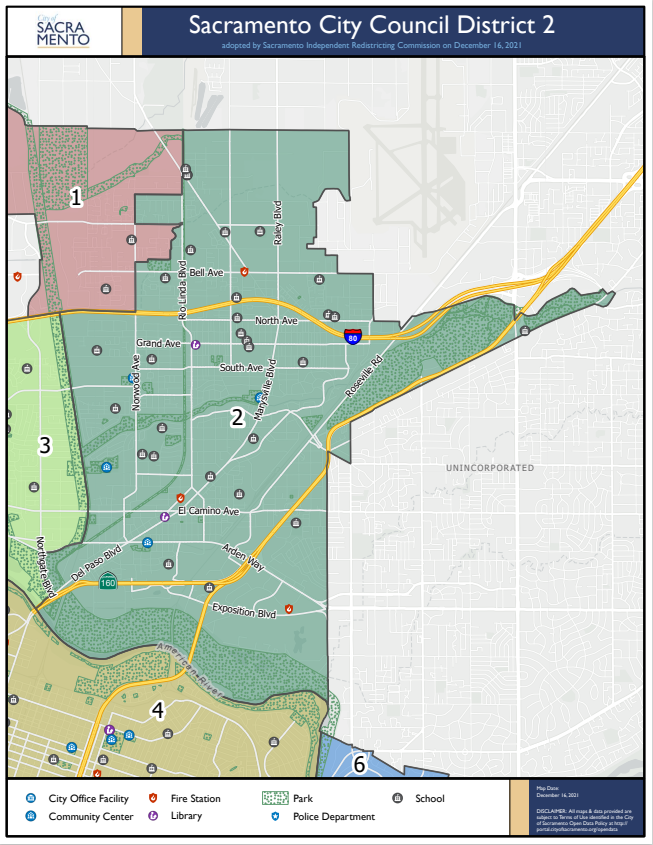
Updated 12/16/2021
Updated 12/16/2021
Council District 3 maps
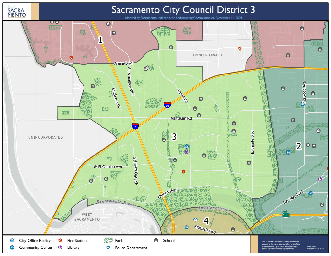
Updated 12/16/2021
Updated 12/16/2021
Council District 4 maps
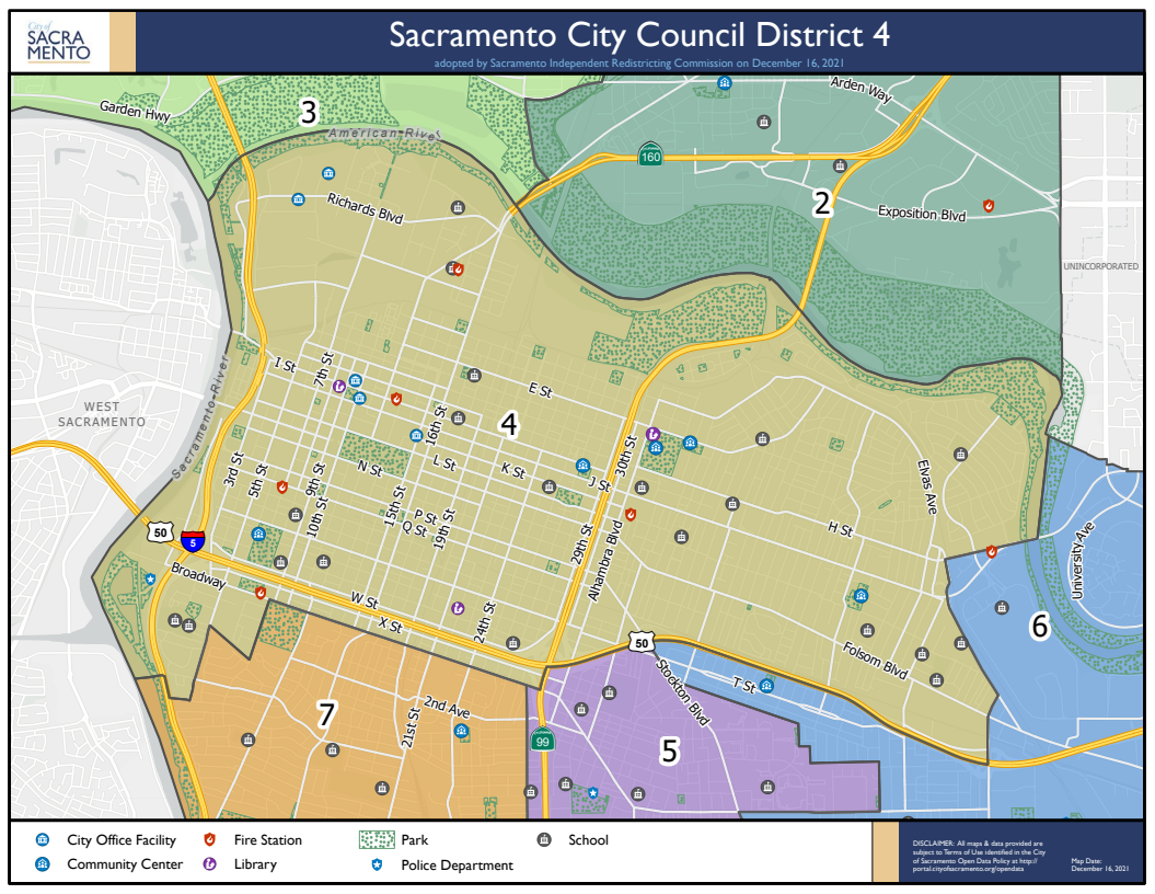
Updated 12/16/2021
Updated 12/16/2021
Council District 5 maps
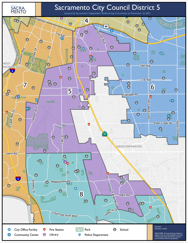
Updated 12/16/2021
Updated 12/16/2021
Council District 6 maps
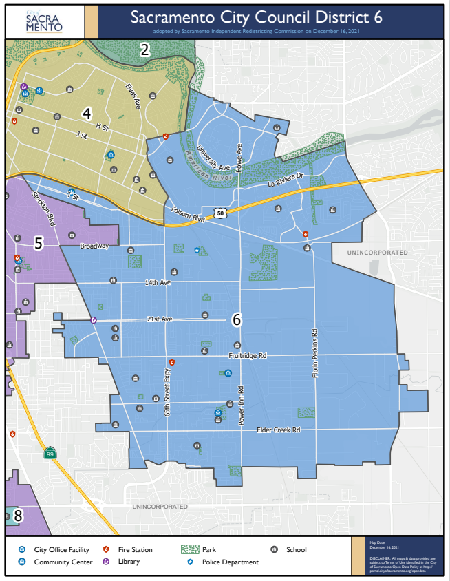
Updated 12/16/2021
Updated 12/16/2021
Council District 7 maps
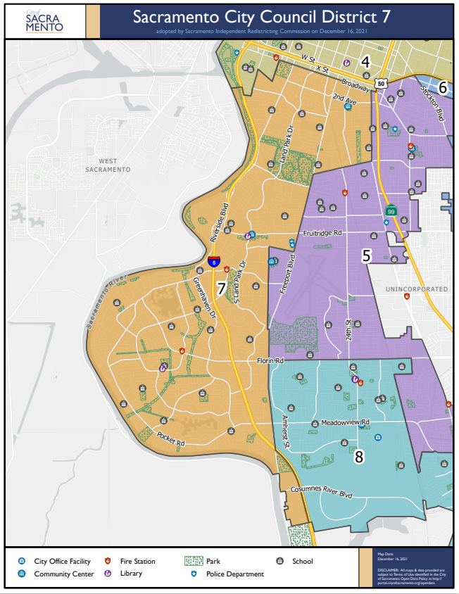
Updated 12/16/2021
Updated 12/16/2021
Council District 8 maps
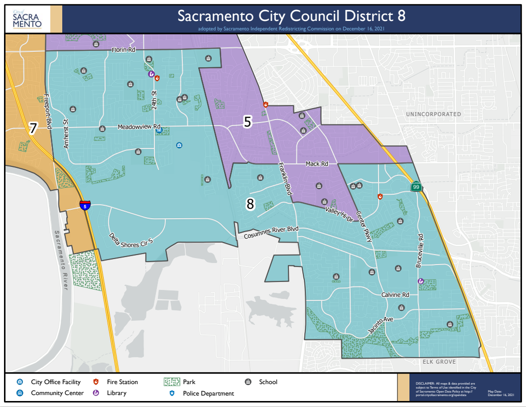
Updated 12/16/2021
Updated 12/16/2021