River District Specific Plan
River District Specific Plan Update
The River District Specific Plan Update began in March 2024. A Public Review Draft Plan is anticipated summer 2026, with public hearings to follow in late 2026.
The existing Specific Plan was adopted in 2011, and much has changed In the River District since then. This update provides an opportunity to revisit the Plan’s goals, policies, and actions and align them with a renewed vision for the area’s future.
To view the current River District Specific Plan (2011), please visit the Specific Plans webpage.
Submit any questions or comments to staff with this form
Sign up for the email list to get notifications on the project.
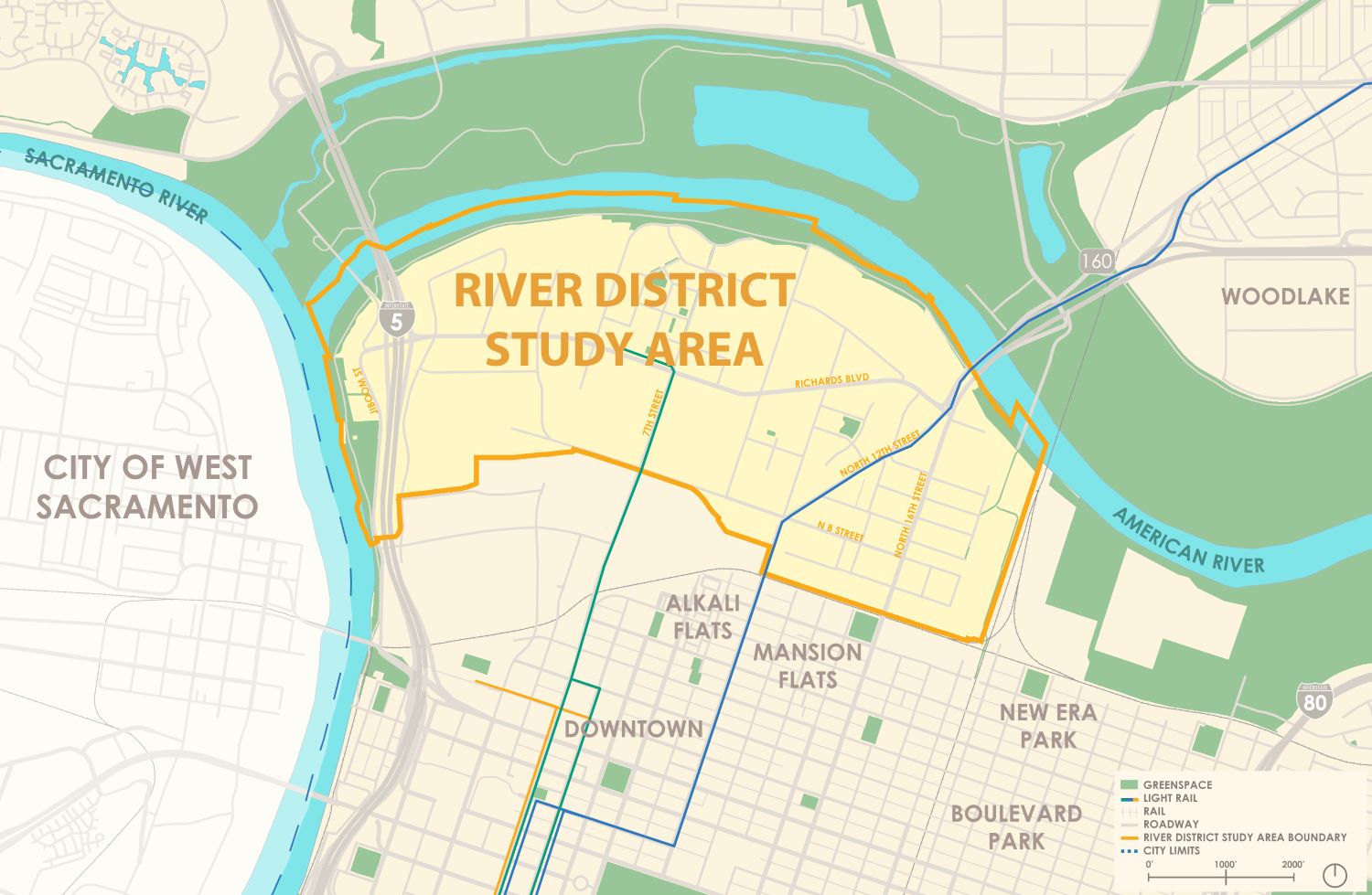
About the River District
The River District Specific Plan area (River District) is located just north of downtown Sacramento and includes around 773 acres of mostly developed land. Bordered by the Sacramento and American Rivers to the west and north, a rail line to the east, and North B Street and another rail corridor to the south, the River District has long been a vital part of the city’s urban fabric. See the map showing the study area boundary.
Historically known for its industrial character, the River District today is a diverse and evolving neighborhood. It includes a mix of established industrial businesses, restaurants, hotels, and essential social service organizations. The area also features a mix of residential communities, a middle school, multiple parks, a museum, and both City and State government offices.
In recent years, the River District has experienced growing interest from developers and investors. Major projects such as the May Lee Office Complex, Township 9, Track 281, and Mirasol Village have brought new energy to the area, signaling continued transformation and opportunity.
Contact
For questions about the update process, contact Alexi Wordell, Associate Planner, at AWordell@cityofsacramento.org.