Reconnecting Old North Sacramento
Project overview
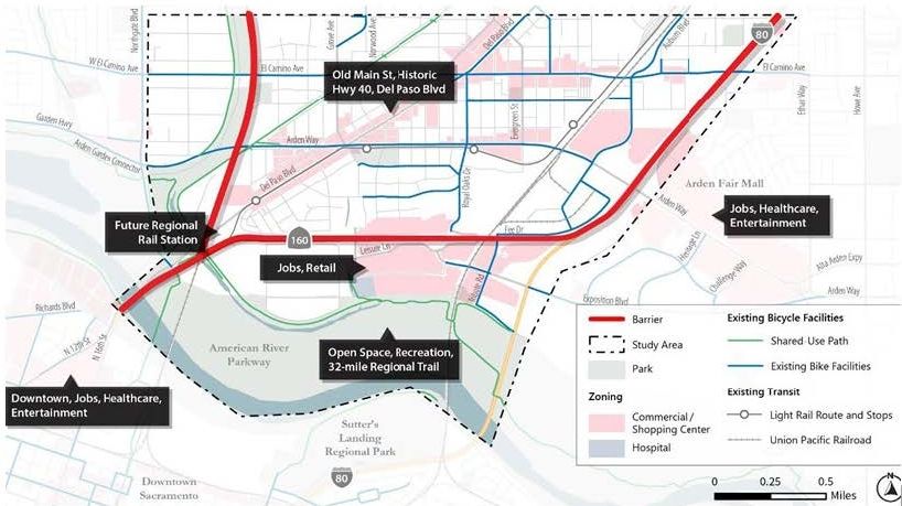
The City will develop a plan, “Reconnecting Old North Sacramento”, to address the impacts and harms to the area communities caused by legacy transportation infrastructure. The planning Reconnecting Old North Sacramento project is the American River to the south, Capital City Freeway to the east, Lampasas Avenue to the north, and Northgate Boulevard to the west.
The Reconnecting Old North Sacramento plan will include recommended infrastructure projects, programs, and policies aimed at reconnecting Old North Sacramento communities through affordable, accessible, and multi-modal transportation.
Community at the Center
Your City staff will work with community members, businesses, organizations, schools and all community partners to ensure the plan reflects your priorities. Sign up below to stay engaged.
What the Plan Will Deliver
Our goal is that this effort will result in a community-driven, implementation-oriented plan that identifies near- and long-term projects, programs, and policies aimed at enhancing mobility, access, and safety for community members, while supporting local businesses and residents.
Stay Engaged
We want to hear from you! Opportunities to participate will be announced on this page and through our partners. There will be opportunities to share your input both in-person and online.
Schedule
It is anticipated that a consultant will be contracted by Spring 2026. This will lead to engagement starting in Summer 2026.
Sign up for Reconnecting Old North Sacramento News Alerts
Submit your comments for Reconnecting Old North Sacramento