Neighborhood Maps and Police Beats
Police Districts and Neighborhood Maps
The Sacramento Police Department assigns officers to predefined areas called beats. Several beats reside in larger areas called districts. Sacramento is divided into six police districts.
North Command: Districts 1 and 2
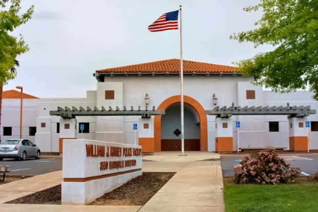
Our North area command operates out of the William J. Kinney Police Facility.
District 1 - North of the American River
District 1 Map (PDF)
Includes: American River Parkway, Creekside, Gardenland, Gateway Center, Gateway West, Greenbriar, Heritage Park, Metro Center, Natomas Corporate Center, Natomas Creek, Natomas Crossing, Natomas Park, Northgate, Pell/Main Industrial Park, Regency Park, River Gardens, RP – Sports Complex, South Natomas, Sundance Lake, Valley View Acres, Village (5, 7, 12, 14), Westlake, Willowcreek. Go to William J. Kinney Police Facility (North Command) page.
District 2 - North of the American River
District 2 Map (PDF)
Includes: Arden Fair, Ben Ali, Cal Expo, Cannon Industrial Park, Del Paso Heights (East, West), Del Paso Park, Erickson Industrial Park, Glenwood Meadows, Hagginwood, Hansen Park Gold Course, Johnson Business Park, Johnson Heights, Noralto, Northpointe, Norwood Tech, North Sacramento, Oak Knoll, Old North Sacramento, Parker Homes, Point West, Raley Industrial Park, Richardson Village, Robla, South Hagginwood, Strawberry Manor, Swanston Estates, Village Green, Wills Acres, Woodlake, Youngs Heights.
Central and East Commands: Districts 3 and 6
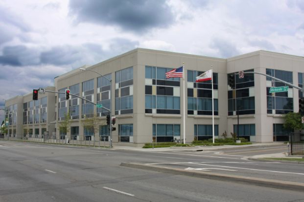
Our Central and East area commands operate out of the Richards Police Facility.
District 3 - Central
District 3 Map (PDF)
Includes: Alkali Flat, Boulevard Park, Capital Avenue, Dos Rios Triangle, Downtown, Mansion Flats, Marshall School, Midtown, New Era Park, Newton Booth, Old Sacramento, Richards Boulevard, Richmond Grove, River District, Southern Pacific Railyards, Southside Park, Winn Park
District 6 - East
District 6 Map (PDF)
Includes: Elmhurst, Med Center, North Oak Park, Tahoe Park, Fairgrounds, Central Oak Park, South Oak Park, Tahoe Park South, Colonial Heights, Lawrence Park, Tallac Village, Fruitridge Manor, Florin Fruitridge Industrial Park ,Depot Park, Avondale, Glen Elder, Southeast Village, West Tahoe Park, Elder Creek, Morrison Creek.
District 7 - East
District 7 Map (PDF)
Includes: River Park, East Sacramento, Campus Commons, Sierra Oaks, CSUS, College/Glen, Alhambra Triangle, Tahoe Park East, Granite Regional Park, Colonial Manor, Colonial Village, New Brighton, Belvedere, Power Ridge, Ramona Village, College Town.
South Command: Districts 4 and 5
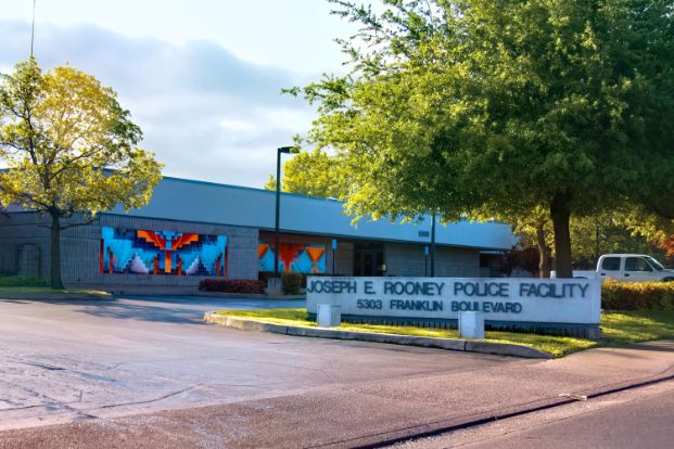
Our South area command operates out of the Joseph E. Rooney Police Facility.
District 4 - Southwestern
District 4 Map (PDF)
Includes: Airport, Brentwood, Carleton Tract, City Farms (South/North), Curtis Park, Freeport Manor, Golf Course Terrace, Greenhaven, Hollywood Park, Land Park, Little Pocket, Mangan Park, Pocket, Sacramento City College, South Land Park, Upper Land Park, Woodbine, Z'Berg Park.
District 5 - Southeastern
District 5 Map (PDF)
Includes: Meadowview, North Laguna, Parkway, Valley Hi.