102-Acre Site
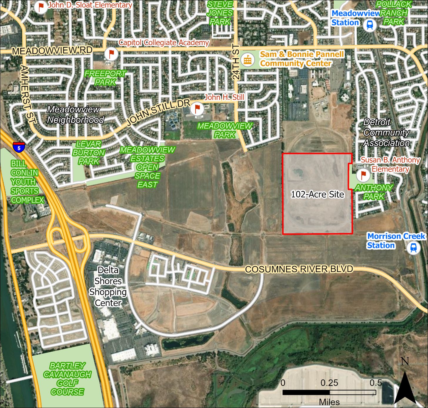
The City purchased 102 acres from the U.S. Department of Labor in January 2022. The 102-acre site is a vacant parcel of land in South Sacramento, as shown in the map below . The City is trying to decide how the site should be used in both the short- and long-term.
The City has conducted an opportunities and constraints analysis to inform both the public and City Council about potential development options and constraints. Before City Council makes a decision, it is important to know as much about the site as possible. The analysis is meant to provide information about the existing conditions, a broad overview of potential ways to use the site, and what considerations Council would need to keep in mind as they make their decisions. The goal for the analysis would be to provide enough information to help City Council answer two key questions:
- How should the site be developed?
- What are the general land uses to be developed at the site?
Based on the findings of the opportunities and constraints analysis and community feedback, City staff released a Request for Expressions of Interest (RFEI) in January 2026. The goal of the RFEI is to better understand market insights, conditions, and trends for the property. Utilizing the information in the responses received, staff plans to develop a land reuse recommendation and seek City Council direction in spring/summer 2026.
Stay connected

Sign up for email alerts and newsletters.

Use a fillable form to get in touch with our team.

Learn more and provide your input.
Site map location